
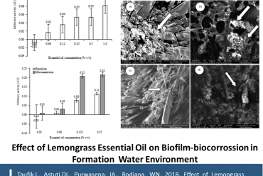
Land-Cover and Elevation-Based Mapping of Aboveground Carbon in a Tropical Mixed-Shrub Forest Area in West Java, Indonesia
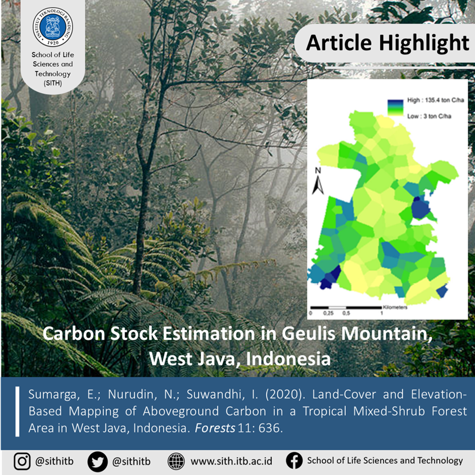
 Carbon sequestration and storage are among the most important ecosystem services provided by tropical forests. In the recent paper, Dr. Elham Sumarga and the team examined the use of land-cover and elevation-based methods of aboveground carbon mapping in Geulis Mountain to elucidate how much carbon is stored in the forest, providing important input to our forest management.
Article Citation:
Sumarga, E.; Nurudin, N.; Suwandhi, I. 2020. Land-Cover and Elevation-Based Mapping of Aboveground Carbon in a Tropical Mixed-Shrub Forest Area in West Java, Indonesia. Forests 11: 636.
Full paper is published in Forest : https://doi.org/10.3390/f11060636
Image (first page):
Tropical forest (source: Wikimedia.org)
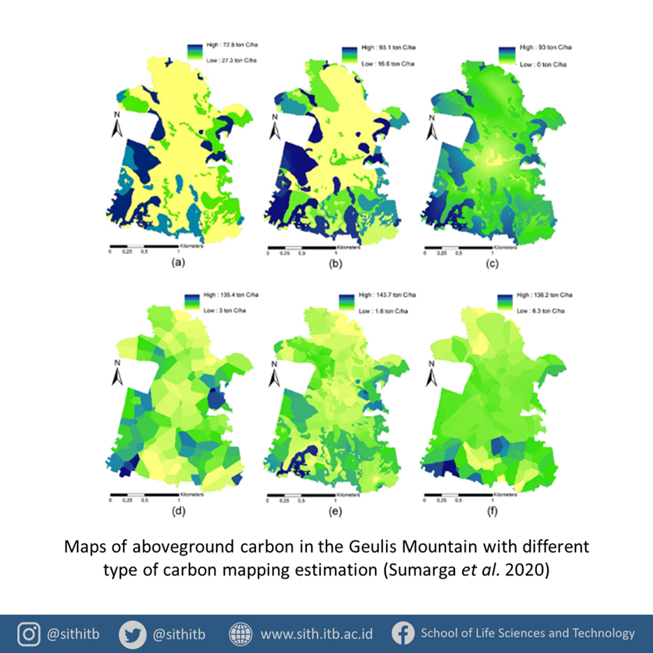
Maps of aboveground carbon in the Geulis Mountain (source: Sumarga et al. 2020)
Profile of Dr. Elham Sumarga:
https://sith.itb.ac.id/en/dr-elham-sumarga/

